

Weather and Winds
Understanding the weather and wind patterns in your sailing area is crucial for a safe and enjoyable yachting experience. Here, we provide an overview of typical weather and wind conditions in Croatia, Turkey, Greece, and the British Virgin Islands (BVI), helping you prepare for your journey.
Croatia
Cyclones and Anticyclones
The weather in the Adriatic Sea, is influenced by the movement of cyclones and anticyclones over central and southern Europe. Cyclones typically move from west to east across the Adriatic, bringing southerly winds (known as the jugo) along with warm, wet air, leading to cloudy and rainy conditions. As cyclones pass and anticyclones take over, the wind shifts to the northeast (bura), bringing cold, dry air. This clears the skies, stabilizes the weather, and temporarily lowers temperatures before sunny, stable weather returns, often accompanied by the daily summer maestral wind.
Summer and Winter Differences
During the summer, the north and south Adriatic regions experience similar weather, characterized by warm, sunny days, moderated by the maestral wind, low humidity, and mild nights. Sea surface temperatures range from 24° to 26°C. In late summer, the north cools more quickly at night, leading to cooler sea temperatures.
Adriatic Winds
The whole eastern part of the Adriatic abounds with local weather variations, where winds take the top position with regard to sailing. Since ancient times, reading the signs of nature has been at the core of the life at sea. Therefore, you won’t go wrong, if you ask a local fisherman, what will be the weather condition today in the evening or tomorrow, what is the best mooring or anchor sites? The wind rose of the Adriatic is made by Jugo (south-easterly wind), Bura/Bora (north-easterly wind), Maestral / Mistral (north-easterly wind), Sirocco (southerly wind), Tramuntana (northerly wind), Levanter and easterly wind. Regardless of all these Adriatic winds, special attention shall be given to Bura and Jugo, and there are good reasons why. First of all, our goal is to present the Adriatic winds and make them easy for you to recognize, to take advantage of their energy, as well as to timely react at their formation and reach swiftly a safe harbour.
Bura – a cold Adriatic wind
As a cold wind, Bura vertically descends the slopes of the coastal mountains and moving towards the sea. It thus creates dust clouds that reduce visibility. Bura is announced by a “cap” of clouds that seem as though they have grabbed the high mountain peaks – Velebit in the north Adriatic, Mosor and Biokovo in the south Adriatic. It rarely blows for more than three days. When Bura is of local origin, it will blow itself out in less than a day. Since it brings cold and heavy air, it finds its way towards the sea through mountain faults and between higher mountain ranges. Bura blows in gusts and therefore might be very severe and unexpected, so, if you have not encountered Bura so far, we advise you to reach the nearest harbour.
The areas where some of the strongest Bura winds occur are: Trieste Bay, Velebit channel famous for the Bura of Senj), Vinodolski channel, Bay of Novigrad, areas around Sibenik, Split (in particular Vrulja near Omis), Makarska – lowlands of Biokovo, Zuljan Bay on the Peljesac peninsula, River Neretva estuary, Risan Bay in Boka. On the contrary, areas where some of the mildest Bura winds occur are: western coast of Istria, southern area of Biokovo stretching towards Trogir, from the coast of Poljice to Dugi Rat, as well as the coast of Montenegro. In short, it might be said that where coastal hilltops are lower than 600 meters or more than 4 kilometres from the coast, the mildest Bura winds occur.
Jugo – warm Adriatic wind
Jugo is a south-easterly wind. It blows across the Adriatic when a cyclone develops over the Adriatic area. It brings clouds and rain. The air pressure drops. It develops slowly and it can usually be noticed two or three days in advance. It usually lasts longer than Bura, five to seven days, and even longer in winter.
There is a possibility of the so called dry Jugo, when it blows for a couple of days without bringing rain. Unlike Bura, Jugo is a constant wind that gradually gains strength.
Mistral
Mistral is a “benevolent”, a friendly wind looked forward by especially sailors and all those who enjoy the summer season under its breeze. Mistral is a daily wind blowing from the northwest and created by the differences in temperature between the mainland and sea. It is fairly frequent from spring to autumn and strongest in July and August.
It usually starts blowing around 9 or 10 in the morning, reaches its highest strength in the afternoon and fades at sunset. Mistral is generally weaker in the north Adriatic than in its south.
Tramuntana
Tramuntana is a classical name for a northern wind. The word derived from Latin vertus transmontanus – a wind that blows (comes) across the mountains. This name for a northern wind is widely used throughout the Mediterranean. It is a cold wind of moderate strength (sometimes strong gusts), that usually forms in clear weather. Its appearance announces nice weather.
Levanter
The Levanter refers to an easterly wind. The name comes from Italian levante meaning east, whereas the word developed from Latin levare: uplift, elevate. It is often a moderate (rarely strong) wind, carrying clouds, moisture and precipitation. When it reaches high intensity, it is described as Levanter.
Ostro
Ostro is a common name for a southerly wind. Its name is derived from Latin auster : south. It is described as a warm and humid wind that usually does not last long, but it might become reach considerable strength.
Libeccio
Libeccio is a south-westerly Adriatic wind described both as lebic and garbin. It is usually a dry and warm wind, which rises across the Adriatic after Jugo, when the Mediterranean cyclone arriving from the sea reaches the western and central coast of Croatia. It usually does not last long, but it might give violent squalls (lebicada). It is especially dangerous because of wave “crossing” and rising of the sea surface in shallow harbours that are open to the south-west. Garbin, grbin, garbinada (from Arab gharbi) is a very strong, sudden and short-lived south-westerly (or westerly south-westerly) wind. It can cause muddy waters, in case of sand or gravel beaches.
Tides, Currents, and Waves
Adriatic tides have small amplitudes and minimal impact on navigation. Currents are generally weak. Waves generated by the jugo are longer but less steep than those caused by the bura, which are shorter, steeper, and can exert greater stress on boats.
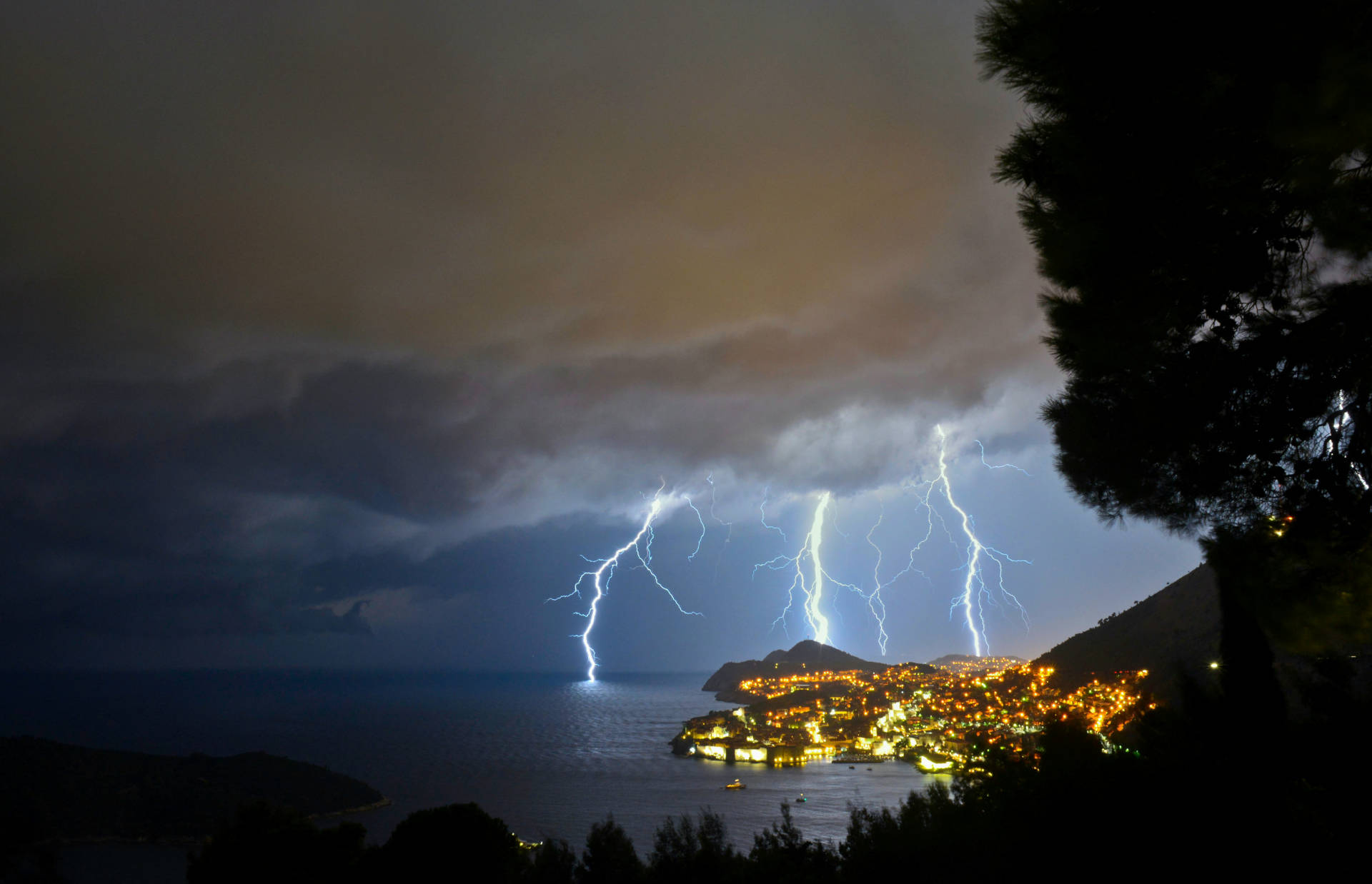
Squalls
Squalls, sudden and intense weather disturbances, are common in the Adriatic during summer. They approach swiftly from the west and are brief but can be severe. It's essential to seek shelter at the first sign of a squall to ensure safety.
Turkey
Cyclones and Anticyclones
Turkey’s coastal weather, particularly along the Aegean and Mediterranean Seas, is influenced by Mediterranean cyclones and anticyclones. Cyclones bring moist, southerly winds and rain, while anticyclones, moving in from the north or northeast, bring dry and clear weather. The meltemi, a strong northerly wind, dominates the summer and is typical from May until September, providing dry and stable conditions. It reaches its peak from mid-July until mid-August.
Summer and Winter Differences
The Turkish coastline experiences hot, dry summers and mild, wet winters. In summer, the meltemi wind provides relief from high temperatures, with sea temperatures ranging between 25° and 28°C. Winters bring more occasional strong southerly winds.
Tides, Currents, and Waves
Tidal ranges in Turkey are small and usually pose no threat to navigation. Currents are generally weak but can be stronger in narrow straits. The meltemi wind can create significant waves, particularly in the afternoon.
Squalls
Squalls in Turkey are less common than in Croatia but can still occur, particularly in the early autumn or late summer. Sailors should be prepared for sudden changes in weather and seek shelter if necessary.
Greece
Cyclones and Anticyclones
Greece’s weather is heavily influenced by the Mediterranean cyclonic and anticyclonic systems. Cyclones bring southerly winds and rain, while anticyclones bring clear skies and northerly winds. The summer meltemi winds are a defining feature, blowing from the north and providing dry, stable conditions.
Summer and Winter Differences
Greece enjoys hot, dry summers with sea temperatures between 25° and 28°C, and mild, wet winters. The meltemi wind is strongest in the Cyclades, providing consistent sailing conditions but also requiring caution due to its strength and persistence.
Tides, Currents, and Waves
Tides in Greece are minimal and do not significantly affect sailing. Currents are generally weak but can be stronger in narrow channels and around islands. The meltemi can create rough seas, particularly in the Aegean Sea, with significant wave heights in open waters.
Squalls
Squalls are rare in Greece during the summer but can occur in transitional seasons. They typically come from the west and can be intense but short. It’s important to monitor weather forecasts and seek shelter if a squall is approaching.
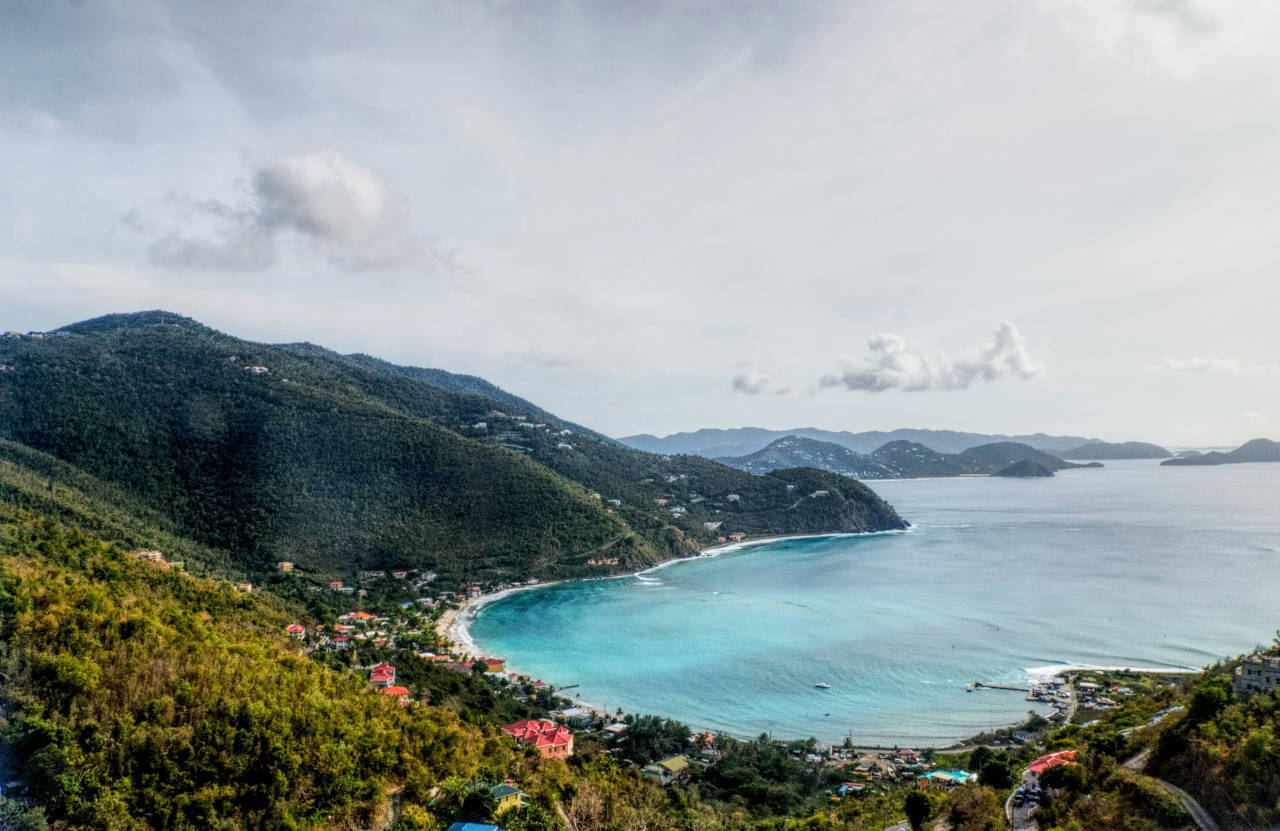
British Virgin Islands (BVI)
Cyclones and Anticyclones
The weather in the BVI is influenced by tropical cyclones (hurricanes) and the Bermuda High, an anticyclonic system. Hurricanes can bring severe weather during the hurricane season (June to November). Outside of this season, the trade winds, blowing from the northeast, dominate, providing stable and predictable conditions. Hurricanes only occur occasionally on the British Virgin Islands. On average, they happen about 4 times a year. However, hurricanes often do not make landfall on the BVI, but turn northward beforehand.
Summer and Winter Differences
The BVI has a tropical climate with warm temperatures year-round, typically between 25° and 30°C. The winter months (December to April) are the dry season, with more consistent trade winds. The summer months are with higher humidity and the risk of hurricanes.
Tides, Currents, and Waves
Tidal ranges in the BVI are small, with minimal impact on navigation. Currents are generally weak but can be stronger in narrow channels and around reefs. The trade winds create moderate waves, which are usually manageable but can be challenging in exposed areas.
Squalls
Squalls in the BVI are most common during the summer months. These brief but intense weather events can bring heavy rain and strong winds. It’s essential to keep an eye on the weather and be ready to take cover if a squall is approaching.
Understanding the weather and wind patterns in these regions will help ensure a safe and enjoyable yachting experience with Orvas Yachting. Whether you're navigating the Adriatic, the Aegean, or the Caribbean, being prepared for the conditions you may encounter is key to a successful holiday trip.